


- On sale!
- -€81.85
 Novinka 2023")
 Novinka 2023")
 Novinka 2023")
 Novinka 2023")
 Novinka 2023")
 Novinka 2023")
 Novinka 2023")
 Novinka 2023")


 Secure Payments
Apple Pay, Google Pay, Credit Card or PayPal.
 Shipping to the EU for €5.99 or free on orders over €99.
Fast shipping via DHL (and partners). If in stock, 2–7 days across the EU.
 Need advice? Call us (English, Czech) or write to us (in your language).
+420 604 111 341 info@mojegs.cz
Additional key features:
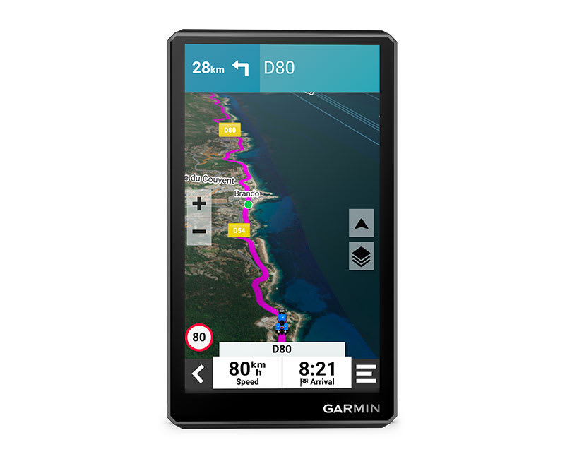
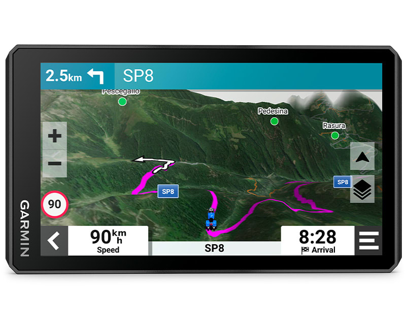
The 6″ display is 15% larger than previous models and offers clearer HD resolution in both portrait and landscape modes.
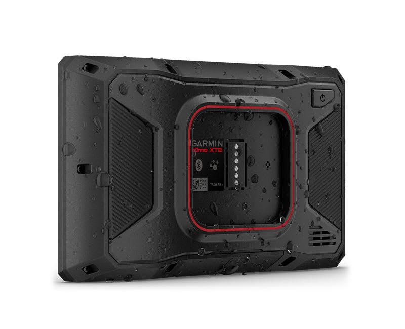
Set out with the confidence that you have a navigator capable of handling any weather (IPX7 rating) and demanding terrain.
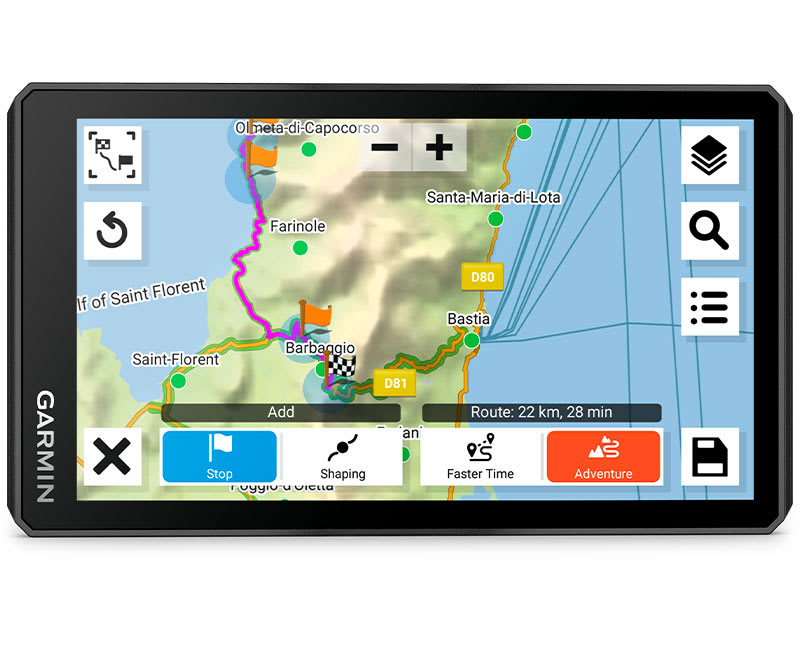
Plan your own route directly on the navigator or use it on a compatible phone.
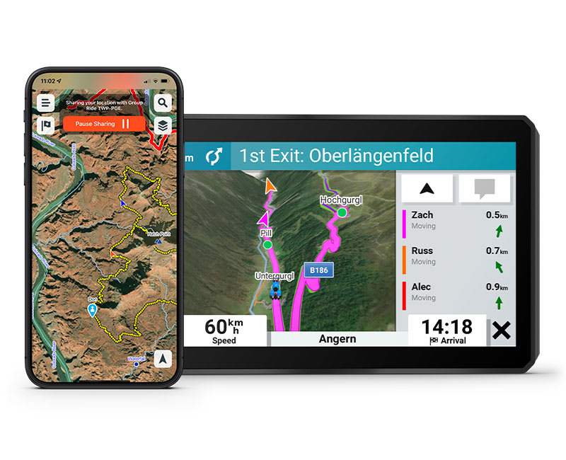
In the Tread® app on your phone or on the zūmo XT2 navigator you can track friends using the group ride function with a mobile phone (1). Or you can use the Group Ride Tracker module2 (sold separately) and track other riders with the zūmo® XT2 navigator even in areas without mobile signal.
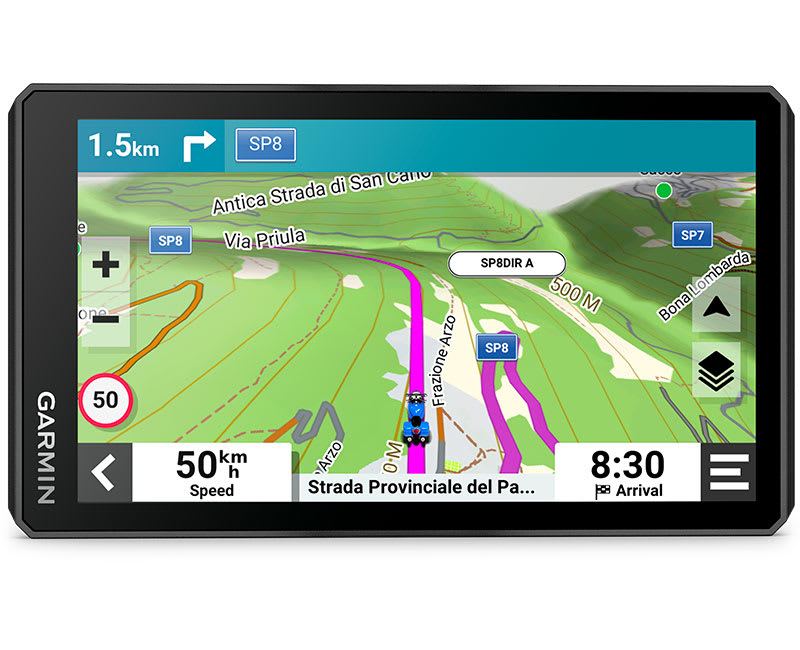
Easy switching between road, topographic maps and satellite imagery, so you always have the map you need.
Satellite imagery from around the world will also help you orient yourself. Via Wi‑Fi® you can download maps directly to the navigation unit3. No subscription required.
The rugged zūmo® XT2 motorcycle navigation unit is suitable for both road and enduro motorcycles. Its exceptionally bright 6″ display is easy to operate with gloves, resists rain and reliably shows the way on-road and off-road.
The bright 6″ display is easy to read in all weather and lighting conditions.
Preloaded scenic roads and the MICHELIN Green Guide.
Use the visual route planner to map your own route.
Garmin Adventurous Routing™ for engaging, adventurous routes.
A selection of popular motorcycle routes.
Head out in a group and track the positions of other riders with the zūmo® XT2 (1).
Straight roads are boring. Experience a proper adventure full of hills, twists and panoramas with four levels of difficulty.
Discover unforgettable rides with MICHELIN Scenic Roads. Use the visual route planner to easily incorporate them into your trip.
Check out popular moto routes ridden by other rizdci, and find new and interesting routes to explore.
In the Tread® app you can view ride details including speed, acceleration, elevation gain and other data.
Record ride data such as speed, distance, acceleration and more. Share details with friends via the Tread® app.
Easily send GPX files from your phone or other services to the zūmo® XT2. You can also share them with other riders via the Tread® app.
Simple management of routes4 on your navigator and compatible phone using
The pre-installed MICHELIN Green Guide with photos, descriptions and ratings to help you decide where it's worth stopping.
The Trendy Places feature highlights the best spots to stop along your route, so you can spend less time planning and more time exploring.
Use the Local Spots feature, which recommends interesting places and activities nearby.
Alerts for sharp turns and changes in speed limits.
Stream music from your phone through the zūmo® XT2 or play filesMP3 files stored on the navigator directly to a paired helmet or headset.
Thanks to built‑in Wi‑Fi3 you can easily update maps and software without a computer. When a new update is available, an on‑screen notification will appear.
Preloaded topographic maps with 3D terrain and road maps of Europe and the Middle East. Maps for Africa (including Tracks4Africa routes), North and South America, Australia and New Zealand can be downloaded for free from garmin.com/express.
The Tread® app provides current traffic and weather information, route sharing with fellow riders, and phone notifications4.
If you are involved in a traffic accident, your preset contacts4 will automatically be sent a text message with your location.
Detailed voice prompts or hands‑free calling from a compatible phone to a paired helmet or headset.
Pair the zūmo® XT2 with a compatible inReach5 satellite communicator to enable two‑way messaging, location sharing, and SOS in emergencies.
Pair the zūmo® XT2 motorcycle navigator with a compatible Garmin PowerSwitch™ digital switching box (sold separately) and you can control the motorcycle's 12V electronics directly on the displays.

Data sheet
Specific References
 Novinka 2023")
Garmin zumo XT-2.


